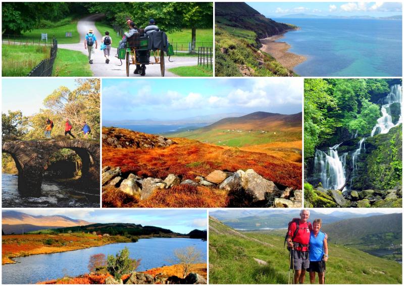
Kerry Way: Trail Info
Introduction
At over 200km, the Kerry Way is Ireland's longest signposted walking trail and is also one of the most popular. The trail starts and finishes in the busy tourist destination of Killarney. Looping around the Iveragh Peninsula, the Kerry Way goes anti-clockwise, passing through some of the most isolated and dramatic countryside in Ireland.
The Kerry Way is the relaxed and unhurried walking version of the world-famous Ring of Kerry driving route. It follows a similar, but more beautiful route around the peninsula, it brings you closer to nature and the beauty of the Irish landscape, and it allows more time to appreciate the magnificent surroundings.
The landscape the route passes through is very varied, from the Lakes of Killarney to high and remote mountain moorland. The route follows a mixture of terrain from roads to boardwalks to forest paths. You will pass through forests, around bays and over summits, all while surrounded by some of Ireland’s most evocative scenery.
You will also get good views of the McGillycuddy's Reeks, where Ireland's highest mountains, Carrauntoohil and Caher, tower over the route west of Black Valley. The return leg passes along the startlingly contrasting semi-tropical south coast. Along this section, you will encounter much different flora than the northern coast of the peninsula, such as palm trees – which are not a common sight in Ireland!
Map
The Route
The Kerry Way leaves the popular tourist town of Killarney and heads south along the shores of Lough Leane into Killarney National Park. From there the trail reaches Torc Waterfall, then follows the Old Kenmare Road and to reach the remote Black Valley in the shadow of the McGillycuddy's Reeks, the mountain range which includes Carrauntoohil, Ireland's highest mountain.
A mountain pass leads into Glencar and Lough Acoose where the trail follows the Caragh River valley before either circling Seefin Mountain or crossing the Windy Gap (#1 of 3) to reach Glenbeigh. The Kerry Way then climbs and follows the hills overlooking Dingle Bay until it reaches Drung Hill, where it turns inland to Foilmore, near Cahersiveen.
From Foilmore, the route bears south and traverses two ridges towards the village of Waterville. Two possible routes lead from there to Caherdaniel: a coastal trail around Farraniargh Mountain or a longer inland trail, crossing Capall River and mountains via Windy Gap (#2) to Caherdaniel.
An old coach road now brings the Way to Sneem and onwards to Kenmare by a trail that follows the coast above Kenmare River. The final section crosses the mountains between Kenmare and Killarney via another Windy Gap (#3), there re-joining the outbound route of the Kerry Way at Galway's Bridge, and retracing the route through Muckross to the end in Killarney.
Terrain Overview
The Kerry Way covers a wide variety of terrain, from the firm footing of tarmac roads to more rugged sections out on wild mountainous countryside. The trail follows small ‘green’ roads, commonly known as 'boreens', long-abandoned coach roads and mass paths that are now overgrown with grass but nonetheless, quite firm underfoot. There are also sections that cross through forestry, national parks and farmland which can become quite boggy in places. Some sections in the mountains and on the open moorland can be very isolated and off-road sections can occasionally be wet and muddy.
Though it skirts around Ireland’s highest mountains, the Kerry Way avoids the higher peaks and opts for the lower reaches of mountain ridges. Total aggregate ascent over the whole route is approximately 5,400m, and there are some sustained and quite steep climbs, especially between Black Valley and Glencar. Along this section, you will also pass over the highest point of the route, which is found at the top of the Lack Road, and is only 385m above sea-level.
Elevation Profile (Click image to enlarge)
Terrain by Stages
Black Valley – Killarney: Remote, sometimes rugged tracks through wild, stunning surrounds. This is followed by paved footpaths.
Black Valley – Glencar: Old valley roads and mountain paths and tracks. Two stiff climbs over rugged ground. Damp in places.
Glencar – Glenbeigh: A mixture of quiet road walking, forest paths and mountain tracks.
Glenbeigh – Foilmore: Mixture of forest path and minor roads, then cross country along the remains of a disused railway line in mountainous countryside.
Foilmore – Waterville: Undulating, rugged low mountain terrain; cross country and minor roads. Boggy in places.
Waterville – Caherdaniel (Coastal Route): Minor roads and a pleasant coastal path. Undulating but not strenuous.
Waterville – Caherdaniel (Inland Route): Undulating, rugged mountain terrain, cross country and minor roads. Boggy in places.
Caherdaniel – Sneem: Disused old mountain roads, paths and some minor surfaced road.
Sneem – Kenmare: Forest paths, farm lanes and minor roads. One busy road section of 2.5km. Some boggy patches.
Kenmare – Killarney: Minor roads out of Kenmare, then a remote old mountain trail over the hills to Killarney.


