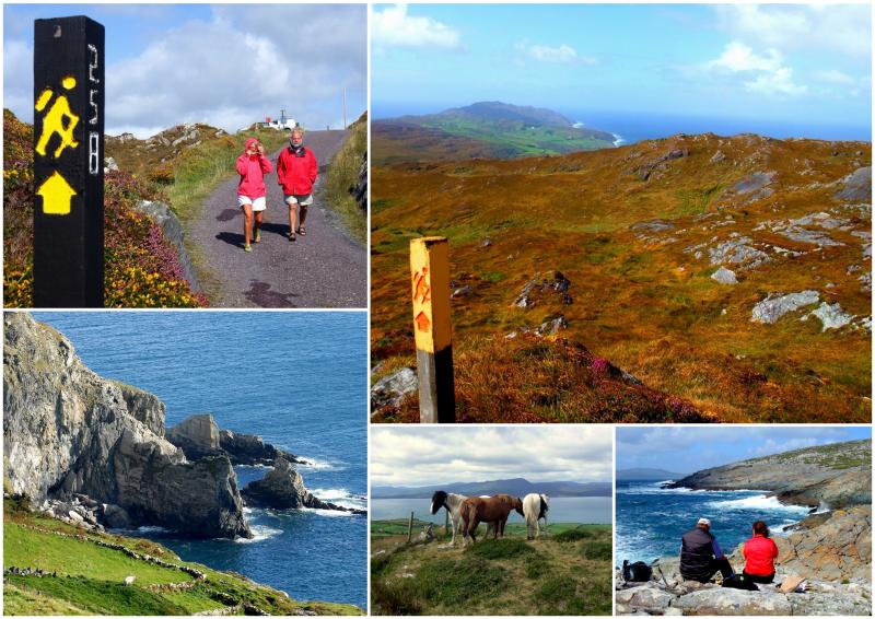
Sheep's Head Way: Trail Info
Introduction
The Sheep’s Head Way is a 93km (58 mile) long National Waymarked Trail that circles the Sheep’s Head Peninsula in West Cork. The Sheep’s Head is a peaceful, unspoilt peninsula and it is said to contain the most beautiful scenery in all of Ireland. Because of its proximity to the Gulf Stream, it also has perhaps the mildest climate in Ireland - the daffodils are usually out in January! The narrowness of the peninsula means that you are never far from the glorious Atlantic Ocean.
The remains of an old copper mine, a blow hole, stone circles, standing stones, high cliffs, a Napoleonic signal tower and old churches are some of the varied attractions to be discovered along the way. Patience may be rewarded by sightings of dolphins and whales off the westernmost tip of the headland. Here too, you will find the Sheep's Head lighthouse.
This route is a former winner of the ‘Waterford Crystal Walker Award’ and was chosen as the best walk in Ireland by Country Walking magazine.
Map
The Route
The wild circular walking route begins in the town of Bantry in County Cork and runs out along the lonely north coast of the peninsula. On the way, it offers incredible views out to the Atlantic Ocean from the rugged mountain ridge that it follows. The trail reaches the scenic lighthouse at ‘Sheep’s Head’, at the very tip of the peninsula, and then loops back to cover the southern side of the peninsula.
The southern section of the trail leads through the villages of Kilcrohane and Durrus, via grassy slopes, mountain trails, and coastal roads. From Durrus, the route heads inland, before turning back north to reach Bantry again.
Terrain Overview
The terrain is varied, and includes old boreens (a Gaelic word that literally translates as ‘little road’), open grassy and heathery moorland, field paths, quiet country roads and some short stretches of woodland paths. Approximately 28 km or 31% of the Sheep’s Head Way follows local roads but this is dependent on which tour itinerary you choose.
The route doesn’t have many steep climbs but does include a few ascents which are quite long. The total aggregate ascent is approximately 2,200m over the entire route and the route’s highest point is just 300 metres above sea level at Derrylahard, near Glanlough and east of Durrus.
Elevation Profile (Click image to enlarge)
Terrain by Stages
Bantry – Glanlough: Quiet country roads out of Bantry, followed by a longer and quite steep climb on more rugged terrain along a ridge before descending into Glanlough/Gerahies.
Glanlough – Finn McCool’s Seat: Initial steep climb on rugged mountain terrain. Damp underfoot in places and quite exposed.
Finn McCool’s Seat – Tooreen: A mixture of gentle coastal paths and more rugged mountain terrain. Damp underfoot in places.
Tooreen – Kilcrohane: A mixture of quiet roads, rugged mountain terrain and grassy slopes.
Kilcrohane – Durrus: A mixture of quiet roads, coastal paths and old mountain tracks. Boggy section shortly before Durrus.
Durrus – Bantry: Mainly along quiet country roads with some climbs and descents. Occasionally along forest and mountain tracks.


