Wicklow Way: Trail Info
Introduction
The 130km long Wicklow Way was Ireland’s first waymarked trail, and due to its proximity to Dublin, has remained one of the most popular walking routes in Ireland. It was the brainchild of a Dublin hillwalker, J.B. Malone and opened in 1981.
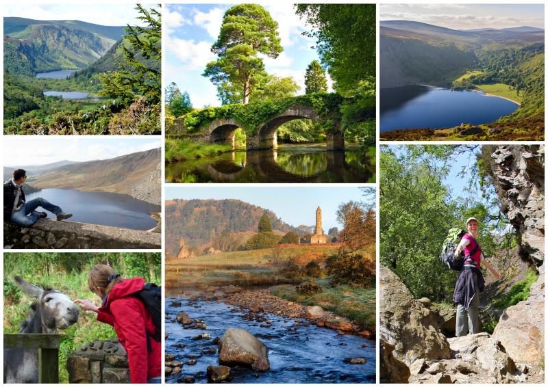
Despite its proximity to the capital of Ireland, the Wicklow Way contains many kilometres of wonderfully unspoilt mountain trails and a wide variety of scenic experiences, some of them in truly remote upland areas. They include mountains, upland lakes, steep sided glacial valleys, fast flowing mountain streams, forests and farmland.
The trail passes many examples of historical human habitation – the most famous being the early Christian monastic settlement established by St Kevin in the beautiful Glendalough valley. Here you will see the Round Tower which is almost 1000 years old, and was built by the monks of the Glendalough monastery.
The trail is a pleasure to walk, well signposted, with rougher sections of the track graded to prevent erosion. The central section is covered by the Wicklow Mountains National Park. The Wicklow Way route is also a section of the E8 European Long Distance Walking Trail which extends across Europe and links Ireland with Istanbul.
Map
The Route
Although the Wicklow Way is often walked from north to south, most of Hillwalk Tours’ itineraries walk it from south to north. This has the advantage of having a few days to get leg muscles loosened up on the low-level terrain in the south before heading north into the more taxing mountain region. This direction also ensures that most of the travelling is done on the first day and when walkers finish their tour, they are close to Dublin City centre.
The Wicklow Way starts in the County Carlow village of Clonegal (near Bunclody) and for the first 50km it crosses a series of gentle foothills. It then enters the Wicklow Mountains, with its high rounded ridges and deep valleys, and visits the ancient and beautiful monastic site of Glendalough. From there, the route moves deeper into high, heathery moorland before finishing in the southern suburbs of Dublin.
It is a richly varied route, with the more dramatic scenery of mountains and lakes at the northern end, where, although there is a strong sense of remoteness and few habitations, you are never very far from a public road.
Although the southern part of the route is less scenically impressive, the climbs are gentler as the trail winds its way along forestry roads through a landscape of forest covered foothills. The route doesn’t pass through many towns or villages, so most of the day-to-day walking is remote.
Terrain Overview
The terrain consists of forestry tracks, quiet roads, boreens (a Gaelic word that literally translates as ‘little road’) and mountain paths through open moorland. Some sections can occasionally be wet and muddy. The total aggregate ascent is approximately 3,200m over the entire route and there are some steep sections with longer climbs. The highest point is at Djouce where the trail reaches a little over 600m.
Approx. 39km or 30% of the total Wicklow Way route follows local roads, to avoid walking on private land, but this percentage can be much lower depending on which tour itinerary you choose. In general, there is more road walking in the southern part of the route.
Elevation Profile (Click image to enlarge)
Terrain by Stages
Clonegal – Shillelagh: This section consists of quiet country roads and forest trails through rolling hillside.
Shillelagh – Tinahely: Forest tracks, farmland and quiet country roads make up this part of the trail. One section can be muddy in wet weather.
Tinahely – Iron Bridge: A mixture of grassy mountain paths, forest tracks and minor roads. Lots of ups and downs but not particularly steep.
Iron Bridge – Glenmalure: Forest tracks and quiet mountain roads between these two locations. There is one long climb along good surface.
Glenmalure – Laragh: There is one long, steep climb along forest tracks to begin. Descend then along a track or a mountain path (depending on which route option you take) to Glendalough/Laragh.
Laragh – Roundwood: A gentle and well maintained mountain path followed by a long walk on a quiet road. The route option to the summit of Scarr is on a rugged, albeit well-defined, mountain path.
Roundwood – Enniskerry: Forest tracks and a short section on a quiet road, then mountain paths and boardwalks. Halfway, the highest point of the walk is reached near Djouce (600m). There are a few longer climbs and one that is shorter and a little steeper.
Enniskerry – Marlay Park: This section has quiet mountain roads, paths and tracks. Two climbs before a long descent to the outskirts of Dublin City.


