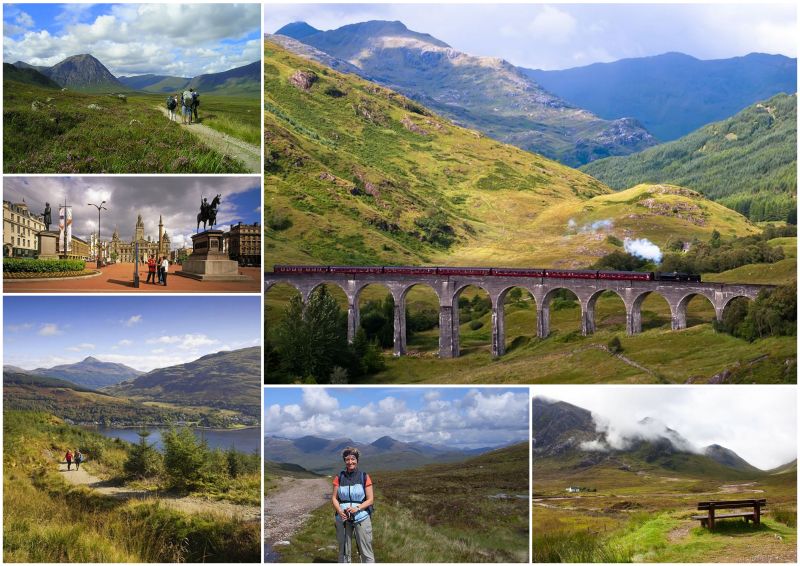
West Highland Way: Trail Info
Introduction
The West Highland Way is a 155km (96 mile) long route, running from Milngavie, north of Glasgow, to Fort William in the Scottish Highlands. It is one of Scotland's official Great Trails. The trail offers breath-taking scenery as you hike into the heart of the Highlands and it is considered one of the classic long distance walks of the world. It was opened in 1980 as the first official long distance footpath in Scotland and it is now part of the International Appalachian Trail.
The usual convention is to describe and walk the route from south to north. The thinking behind this being, the southern stages are easier, and will prepare walkers for the more demanding northern stages.
Map
The Route
The West Highland Way starts in Milngavie town centre, just 25 minutes by train from Glasgow Central Station. From here, the trail enters open countryside and leaves the northern fringe of Glasgow City. It proceeds by way of country roads, an abandoned railway line, a Forest Park and scenic Conic Hill to reach Balmaha on Loch Lomond.
From here, the route follows the isolated, wooded, eastern shores of the loch via Rowardennan and Inversnaid to Inverarnan. This is the most rugged and difficult section of the route with no major climb, but many ups and downs that can get very tiring. The Way then continues northward to Tyndrum via Crianlarich.
North of Tyndrum the Way enters more remote landscapes and passes through Glen Orchy before crossing the desolate yet beautiful moorland of Rannoch Moor and descending into famous Glencoe. Glencoe is often considered one of the most spectacular and beautiful places in Scotland. The narrow glen shows a dramatically grim grandeur, shut in on both sides by wild and precipitous mountains. From here, the route climbs the Devil's Staircase before a gradual descent to Kinlochleven.
The final stage skirts the Mamore Mountains on an old military road and descends into Glen Nevis before finishing in Fort William. The trail then passes the foot of Ben Nevis and many walkers crown their achievement of walking the Way by climbing the highest mountain in Britain.
Terrain Overview
The terrain over the course of the West Highland Way is varied and includes wide smooth tracks in forests, twisty paths over moorland, hillside paths, undulating paths in trees, and field paths. The trail makes use of some ancient and historic routes of communication, such as military roads, disused railway tracks and drovers' roads.
The trail avoids the high tops and is within the capabilities of most walkers. One of the most difficult sections is the walk up the eastern shore of Loch Lomond, whilst some other sections are very exposed. Total aggregate ascent over the whole route is approximately 3,900m, and there are a number of sustained and quite steep climbs, especially near Glencoe. The highest point on the Way is the Devil's Staircase at 550m.
Due to the high volume of walkers, some parts of the trail often become badly eroded. However, a considerable amount of work is routinely undertaken to maintain the route. The trail passes through a variety of woodland and forest areas, some natural and some artificially created. The forests along the route are now well protected as their conservation status was established at the Rio Biodiversity World Summit in 1992.
Elevation Profile (Click image to enlarge)
Terrain by Stages
Milngavie – Drymen: Good footpaths, tracks and lanes, mainly flat and low-lying; some walking on tarmac.
Drymen – Rowardennan: Mainly good paths and tracks with one challenging climb. The beautiful lakeside section along Loch Lomond is twisty and undulating.
Rowardennan – Inverarnan: A demanding and isolated walk on a path along Loch Lomond, occasionally tough underfoot with many ups and downs. It includes some quite challenging sections but offers superb scenery.
Inverarnan – Tyndrum: Generally good paths and gravel tracks with a gradual ascent into the Highlands.
Tyndrum – Inveroran: Clear, well-drained paths and gravel tracks; some moderate ascents and descents.
Inveroran – Kingshouse: A trek across beautiful, isolated and exposed moorland which can be a little challenging in poor weather conditions. The route passes over the Drovers’ road between Bridge of Orchy and Inveroran with large panoramic views and little visibility of civilisation.
Kingshouse – Kinlochleven: Another remote walk with occasional rough stretches and one sharp climb followed by a long descent into Kinlochleven.
Kinlochleven – Fort William: Starting with a steep climb out of Kinlochleven the route follows the contour of a valley which offers little respite from the weather, before forest cover is reached outside of Fort William.


