Rob Roy Way: Trail Info
Introduction
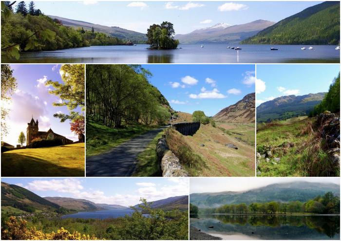
The Rob Roy Way is one of Scotland's Great Trails that stretches for 127km between Drymen and Pitlochry. The trail takes its name from Rob Roy MacGregor and follows the tracks and paths used by this famous Scottish folk hero and outlaw of the early 18th century.
The Rob Roy Way was opened in 2002. It crosses the Highland Boundary Fault, a geological fault where the Highlands meet the Lowlands. The route follows old tracks beside rivers and lochs and climbs over a few passes which provide wonderful views of the surrounding mountains.
For history buffs, the route passes many historical sites such as Roman forts and viaducts, crannogs (homes built on lakes), standing stones, forts and stone circles left by prehistoric settlers, military roads and bridges built by English troops during the Jacobite rebellion. In addition, sites of clan feuds and the tales of Rob Roy's adventures add to the charm of this scenic walk.
Map
The Route
The trail starts in the small village of Drymen, near the southern shores of Loch Lomond, which is easily accessible from Glasgow. The trail then wanders on tracks and minor roads through the Loch Ard Forest to the little town of Aberfoyle in the heart of the Trossachs National Park.
From there, it follows forest and moorland tracks through the Menteith Hills to Callander and then heads upstream on paths beside the River Teith to the foot of Ben Ledi before following the shores of Loch Lubnaig to Strathyre. A long stretch of cycleway leads to the attractive village of Lochearnhead, beside the waters of Loch Earn, and crosses Glen Ogle to the village of Killin.
From here, the route climbs high into the hills on tracks and mountain paths before descending to follow a quiet road along the southern shores of Loch Tay to the hamlet of Acharn. The trail then follows a track with magnificent views above Loch Tay before descending past the ‘Falls of Moness’ to the attractive little town of Aberfeldy. The final stretch is along the River Tay and over the moors to the pretty Victorian spa town of Pitlochry, situated at the foot of Ben Vrackie.
Terrain Overview
The route mainly follows mountain paths, tracks, minor roads and cycle paths, with shorter sections on footpaths. Several sections of the Rob Roy Way travel along quiet single track roads or on asphalt tracks and cycle paths. There is ongoing work to make some route alterations to break up some of these sections with softer terrain.
Although the trail passes through some fine highland scenery, it avoids the summits and keeps mainly to the glens. Aggregate ascent over the whole route is approximately 3,000m in total, but the walking is mostly very straightforward.
Elevation Profile (Click image to enlarge)
Terrain by Stages
Drymen – Aberfoyle: Almost entirely along quiet minor roads initially and then on forestry tracks to Aberfoyle.
Aberfoyle – Callander: Forest tracks, minor roads, and paths with some boggy sections. The route climbs gently through the forests of the Trossachs beneath the Menteith Hills before descending - with grand views - to Loch Venachar and Callander.
Callander – Strathyre: The route mostly follows a well-made cycle path and some forest trails.
Strathyre – Lochearnhead: The Rob Roy Way leaves Strathyre with a short, stiff climb on a forest track. The route then follows a cycle path to eventually join an old railway line high above Lochearnhead.
Lochearnhead – Killin: A cycle path along an old railway line heads northwards through Glen Ogle before a final descent on forests tracks that lead to the Falls of Dochart at Killin.
Killin – Ardeonaig: A long climb out of Killin on a minor road. A mountain track then leads across high, open moorland on the south side of Loch Tay to the trail's highest point on the slopes of Ceann Creagach (555m) - the moorland section here can be boggy and exposed in poor weather.
Ardeonaig – Acharn: This stage of the Rob Roy Way follows the very scenic minor road on the south side of Loch Tay for 12.5km from Ardeonaig.
Acharn – Aberfeldy: The trail climbs a track past the ‘Falls of Acharn’ before following grassy tracks and paths across a hillside of open fields, forestry and moorland. There are some short, stiff climbs. It descends on well-managed footpaths through the Birks of Aberfeldy and past the Falls of Moness into Aberfeldy.
Aberfeldy – Pitlochry: A riverside trail follows the River Tay eastwards from Aberfeldy to the attractive village of Grandtully. A final climb then leads up over the moors on a more rugged mountain trail with one sharp climb, boggy in places. Descent on forest tracks before the journey's end at the town of Pitlochry.


