Hadrian's Wall Path: Trail Info
Introduction
Hadrian’s Wall Path is a long distance National Trail in the north of England. It runs for 135km (84 miles), from Wallsend on the east coast of England to Bowness-on-Solway on the west coast, and it became the 15th National Trail in 2003. With its well-maintained paths and few climbs, Hadrian’s Wall Path is often considered to be the easiest National Trail in the UK.
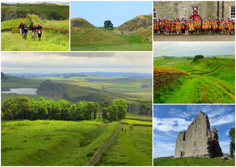
For much of its length, the trail follows close to the remains of Hadrian's Wall, the defensive wall built by the Romans on the northern border of their empire in 122AD, now recognised as a UNESCO World Heritage Site. There's history every step of the way as you pass fine examples of Roman settlements and forts together with cosy pubs, bustling market towns and great views too.
Most of the trail runs through remote countryside and small villages but there are sections that pass through the cities and suburbs of Newcastle and Carlisle. The section between Chollerford and Lanercost/Newtown is the highest and ‘wildest’ part of the path; it is also where the Wall is most visible, and includes several important Roman forts (Chesters, Housesteads, Vindolanda, Roman Army Museum, Birdoswald).
Map
The Route
It's more common to walk Hadrian’s Wall Path starting from Newcastle and heading west. Many walkers feel that it is 'more natural' to walk out of a big city into the open country, and it also makes getting to the start of the walk easier due to the better transport connections to Newcastle. Furthermore, the scenery improves the further west you go - up to a point - and the turrets and milecastles are also numbered from east to west as that is the direction in which the Romans built the Wall.
Departing from Newcastle, near the North Sea, the trail follows mostly railway tracks and footpaths to Newburn. From here, it follows river-side tracks for a small while, before heading away from the river to Heddon-on-the Wall. The route then follows the old Military Road, built on top of the Wall, through a pastoral landscape.
More and more remains of Hadrian’s Wall and its forts, towers and castles become visible as the trail follows the line of the Wall west. The route soon passes the old Roman Portgate, near Corbridge, and then leads on to Chollerford with its Roman Fort of Chesters. From here the trail soon rises to follow the tops of the Northumberland Crags with better-preserved Roman remains.
From Housesteads, it moves on to Once Brewed and then to the lovely village of Gilsland. The trail follows the Wall through a more level landscape via Newtown to the ancient city of Carlisle. Following the River Eden and then moving through the flat landscape along the Solway Firth the route soon reaches Bowness-on-Solway on the Irish Sea.
Terrain Overview
The walking on this trail is relatively easy along footpaths, cycle lanes, well-maintained paths and tracks through fields and on good paths along the top of the Northumberland Crags. Though sometimes muddy in places, there is very little rugged or very wet ground.
There are some minor climbs and a little undulating terrain in the central section but for much of its length the path is more or less flat. The total aggregate ascent is approximately 1,600m over the entire route and the highest point is just 345 metres above sea level.
Elevation Profile (Click image to enlarge)
Terrain by Stages
Wallsend to Heddon-on-the-Wall: A river-walk on cycle lanes and footpaths through the vibrant city of Newcastle followed by a former ‘Waggonway’ track and some minor roads.
Heddon-on-the-Wall to Chollerford: This section is almost entirely through open countryside on grassy paths, alongside the B6318 ‘Military Road’, which was built on top of the Wall.
Chollerford to Once Brewed: Start out on paths alongside a road, followed by off-road paths which run parallel to the Wall. The trail then starts climbing up to the ‘crags’ (hills) and follows a more undulating route with a number of ascents and descents.
Once Brewed to Lanercost: Initially undulating, with a number of ascents and descents along the crags, followed by sections across open countryside on grassy paths with the Wall often visible.
Lanercost to Carlisle: On this leg, the path returns to more level farmland and at a certain point runs alongside the River Eden and passes through a pleasant park. Mostly paths, some asphalt.
Carlisle to Bowness-on-Solway: Initially, the trail runs alongside the River Eden on a footpath, then continues on tracks through level farmland. Later, a footpath runs alongside the flat marshes of the Solway Firth (coastal waters).


